Nobody talks about Sugar Loaf Mountain. And honestly, that’s on us as a hiking community — because the view from the top is one of the best you’ll get within an hour of Kingston.

We took the Lifestyle Hikers crew out to Gordon Town, St. Andrew, passed through Penfield on the way in, and pushed all the way up to the summit of Sugar Loaf. This is the full breakdown of what that hike is actually like.
Where Is Sugar Loaf Mountain?
Sugar Loaf sits in the Blue Mountain foothills above Gordon Town, St. Andrew. The name comes from the shape of the peak itself — steep, rounded, and cone-like, the same form as the traditional raw sugar blocks that defined Jamaica’s colonial export economy. That naming pattern shows up all over the Caribbean for the same reason.
Gordon Town is your entry point. It’s about 30 minutes from Kingston and sits along the Hope River. From there you head up into the hills toward the Sugar Loaf district.
The Trail
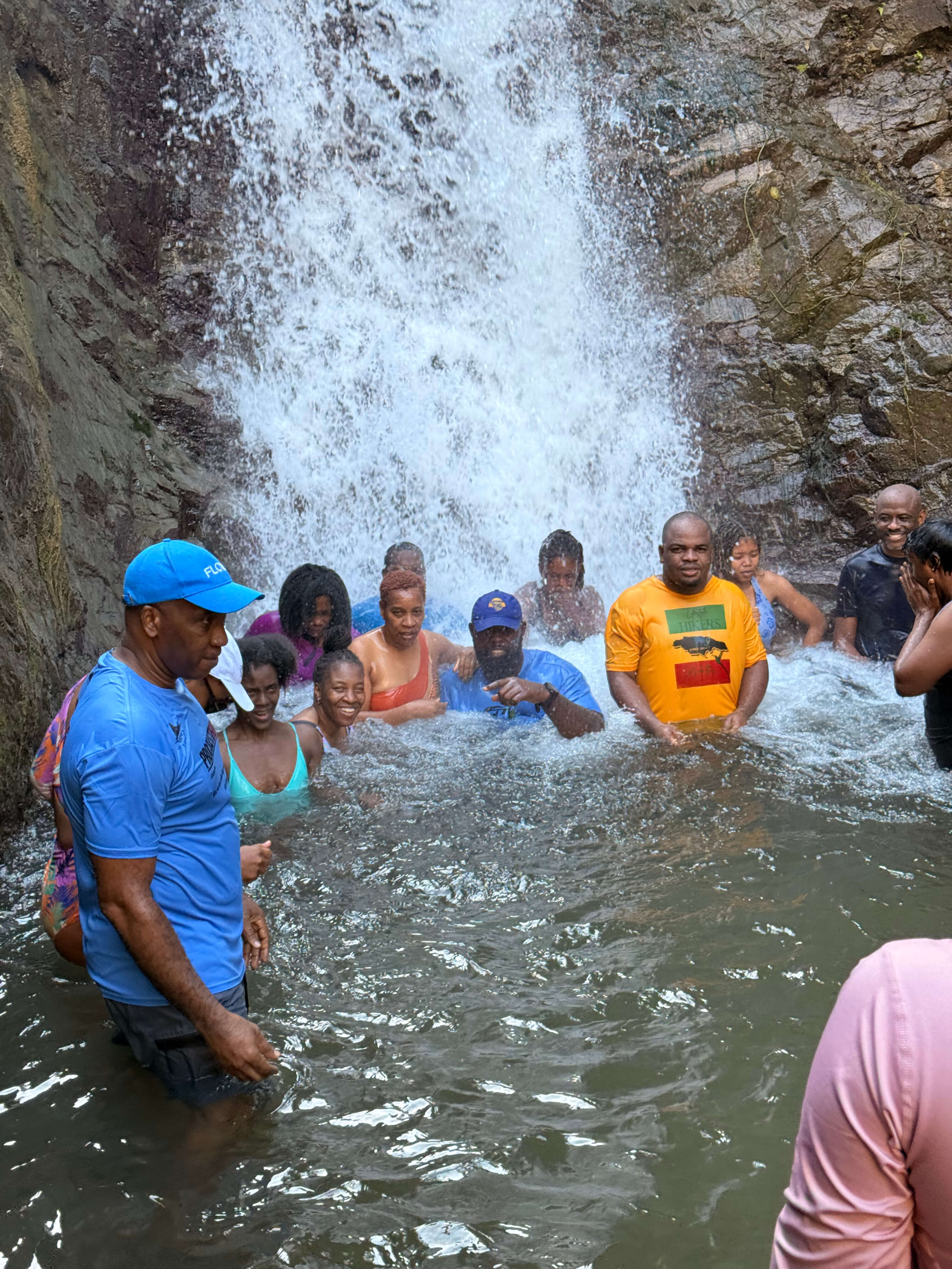
The hike starts near Penfield Square in Gordon Town. You’ll pass through the Penfield community and along Penfield Falls on the way up — the falls are a nice landmark but they’re not the destination here. The real work begins once you start gaining elevation toward the Sugar Loaf peak.
The trail is not formal. There are no markers, no maintained path, and no signage. The terrain shifts between narrow hillside tracks, rocky scrambles, and sections where the vegetation has basically reclaimed the route. A local guide is not optional on this one — it’s genuinely easy to lose the line if you don’t know the mountain.
The surface underfoot is loose shale and limestone for most of the climb. It’s the kind of rock that looks solid and isn’t. Slips happen. Slow down on the descents especially.
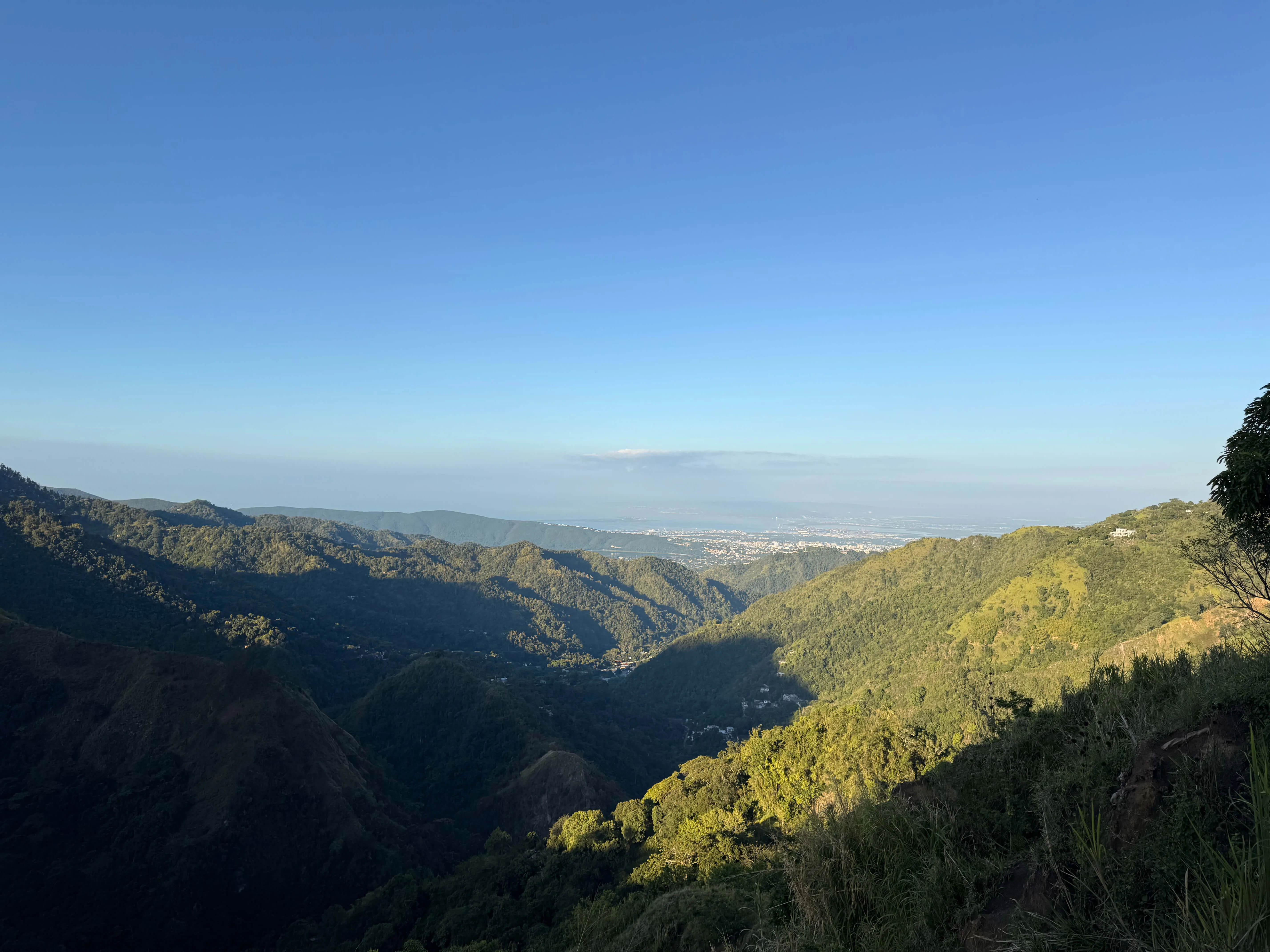
The reward is the summit. Once you clear the tree line and get to the top of Sugar Loaf, you’re looking out over the Blue Mountain foothills with Kingston visible below on a clear day. That view is the whole reason you came.
Trail Details
-
Start point: Penfield Square, Gordon Town
-
Difficulty: Moderate to Difficult
-
Estimated time: 1.5 to 2 hours up, depending on pace
-
Surface: Loose shale, limestone, narrow bush path
-
Guide: Required
-
Amenities: None
Before You Go
Wear proper hiking boots. The loose rock on the way up and especially on the descent will punish anything less. Pack enough water for a full morning out since there is nothing available on the trail. Start as early as you can, the exposed sections of the climb get hot once the sun is fully up, and the views are better before the haze builds.
Check the weather before you commit. Rain turns the limestone into something close to ice. If it rained the night before, expect slower going and grip your footing carefully on any downward section.
The History Underneath Your Boots
Gordon Town was established in 1811 by Dr. John Gordon on land that previously served as botanical garden territory. The town became a transit point for Blue Mountain coffee moving down from the peaks toward Kingston. The Alberga Bridge from 1789 still stands in town and is worth a look before you head up.

The mountains above Gordon Town carry deeper history than most hikers think about. These ridges were part of the resistance geography used by the Maroons — runaway enslaved Africans who used the dense forest and steep terrain as cover and defense. Nanny Town, one of the most significant Maroon strongholds in Jamaica, is in this same mountain range. The landscape that challenges you on this hike was once life or death terrain.
What You’ll Walk Through
The vegetation on the way up is mixed tropical forest with agricultural plots woven through. You’ll pass banana and mango trees, soursop, and patches of wild medicinal plants including vervain and Leaf of Life that locals have harvested here for generations. The forest gets denser as you gain elevation and the temperature drops noticeably once you’re in the canopy.
Why This Hike Stays Off the Radar
No development, no marketing, no infrastructure. Sugar Loaf doesn’t have a waterfall at the top or a famous name that shows up in travel guides. What it has is a serious climb, a legitimate summit, and a view that makes the whole thing worth it.
Lifestyle Hikers exists for exactly this type of trail. Not the ones with parking lots and tour buses. The ones that require local knowledge, proper preparation, and the willingness to put in the work.
@lifestylehikers