Proofread version from your uploaded draft:
Savage Pen to Penfield Hike, Jamaica: The Trail Built from a Disaster
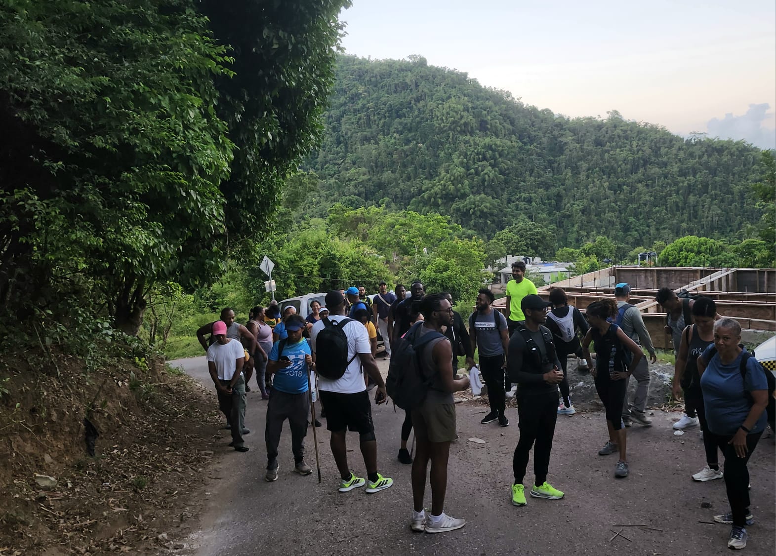
We started with a prayer. That is always the move when the trail ahead is Savage Pen.
This hike, from Savage Pen in Gordon Town through Redlight in Irish Town and all the way to Penfield, is one of the most rewarding and historically loaded walks in Jamaica. It is steep, it is long, and it is absolutely worth it.
If you are looking for a challenging hike in the St. Andrew hills that delivers history, views, and serious elevation, this is the one.
What Is the Savage Pen to Penfield Hike?
The Savage Pen to Penfield hike covers approximately seven miles of mountain terrain in eastern St. Andrew. It begins with the 1.6-kilometre climb up Savage Pen Road in Gordon Town and finishes at Penfield via the Redlight junction in Irish Town.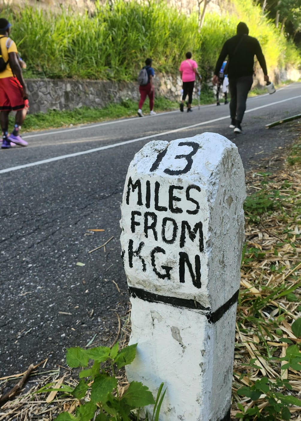
The trail passes through some of the most dramatic landscapes in the Blue Mountains region, connecting working farming communities, colonial-era place names, and a road that only exists because of a national infrastructure emergency.
Difficulty: Level 7 out of 10. For some hikers, it will feel like an 8. Distance: Approximately 7 miles total Starting Point: Savage Pen Road, Gordon Town, St. Andrew Ending Point: Penfield Key Waypoints: Savage Pen summit, Irish Town, Café Blue, Strawberry Hill, Penfield
The Savage Pen Climb: What to Expect
Savage Pen Road is 1.6 kilometres long and gains significant elevation in a short distance. There is no warm-up. The climb starts hard and stays that way until you crest the hill.
This was my third time going up Savage Pen, and each time confirmed what I already knew: the view from the top is worth every step. The St. Andrew hills open up around you, and you get a sense of just how much mountain sits behind Kingston that most people in the city never see.
The road surface is paved asphaltic concrete, laid by the National Works Agency after the 2020 emergency. It is now a proper two-lane road in most sections, though the northern portion remains narrow in places. Expect vehicles to use it, since this is an active community road, not a designated hiking trail.
Pace yourself on the ascent. Hydrate before you start climbing.
Why This Road Exists: The 2020 Gordon Town Crisis
Most hikers do not know the story behind Savage Pen Road, and it is one worth telling.
In November 2020, Tropical Storm Eta hit Jamaica and caused catastrophic damage to the main Gordon Town Road near Stand Up Hill. The embankment collapsed, leaving an eighty-metre drop where the road used to be. The National Works Agency declared the road impassable, cutting off thousands of residents in Gordon Town and the surrounding St. Andrew hills from Kingston and Papine.
The only alternative detour was through Irish Town, Newcastle, and Silver Hill Gap, adding hours to daily commutes and making emergency services significantly harder to deploy.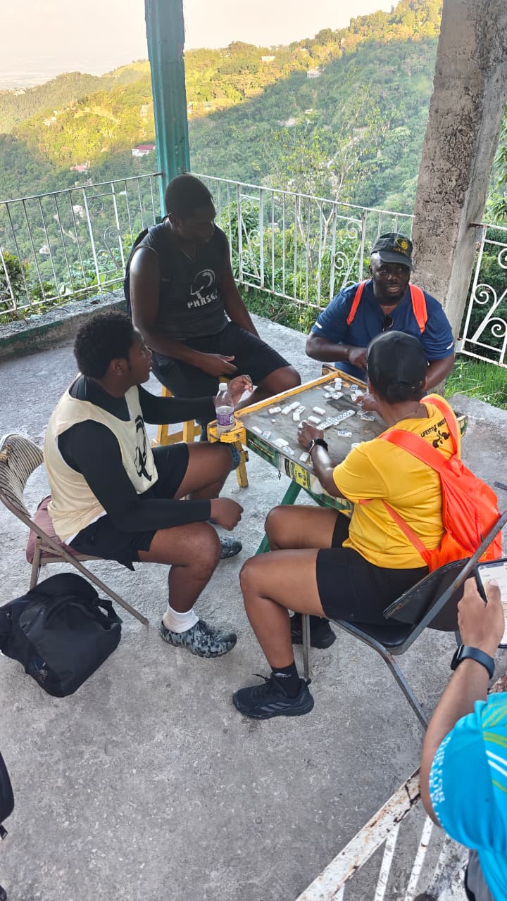
The government, under Prime Minister Andrew Holness, identified Savage Pen Road as the best candidate for an emergency bypass. At the time, locals described it as little more than a footpath. The NWA cut, widened, reshaped, and paved the 1.6-kilometre corridor in a matter of weeks, completing it at a cost of J$60 million compared to the J$200 million required for the permanent repair of the main road.
For farmers, commuters, and emergency services, that road became a lifeline. For hikers, it became one of the most interesting entry points into the St. Andrew mountain trail network.
The History Behind the Name: William Savage and Colonial St. Andrew
The name Savage Pen carries deep colonial roots. In Jamaican geography, the word “pen” historically referred to a livestock property or rural holding in the hills, typically supplying cattle and provisions to lowland sugar plantations. These pen estates were essential to the plantation economy of 18th- and 19th-century Jamaica.
The Savage family, a prominent merchant lineage, gives this area its name. William Savage, born in 1750 in Boston, was a loyalist merchant who fled to Jamaica during the American Revolution and established himself in Kingston. His firm, Duncomb and Savage, traded within the slave economy and managed estates in St. Andrew, including properties in the hills above Gordon Town.
The pen in these hills likely served as a summer retreat and secondary agricultural holding for the Savage family, providing respite from the heat and disease of lowland Kingston. Over time, as happens throughout Jamaican toponymy, the family name attached itself permanently to the land and the district that grew around it.
That history sits underneath your feet as you climb.
From Savage Pen to Irish Town: The Mid-Section
Once you crest Savage Pen, the trail character shifts. The brutal ascent gives way to a longer, more varied journey through the St. Andrew interior.
The route takes you through Redlight and into Irish Town, where Café Blue provides a solid rest stop. Take it. The second half of this hike requires energy, and Irish Town is the right place to reset before the push to Penfield.
The landscape along this section is working farmland. The communities around Savage Pen, Pusey Hill, and Content Gap cultivate yams, cabbage, lettuce, carrots, gungo peas, melons, and oranges, all of which make their way down to Kingston markets. The Topps Mint Factory, which processes cerassee, mint, and fever grass, also operates in this area, reflecting a value-added agricultural sector that most visitors to the Blue Mountains never encounter.
This is not a manicured trail. You are walking through people’s everyday landscape.
Strawberry Hill and the Final Push to Penfield
The route to Penfield takes you past Strawberry Hill, and not many hikers can say they have done that stretch on foot. It is a section that closes the loop on the journey, bringing the trail back toward familiar terrain for anyone who has done the Lifestyle Hikers Sugar Loaf route recently.
The final push to Penfield completes what feels like a geographic circle through the eastern St. Andrew hills, finishing where the wider trail network connects back toward the starting point.
Trail Tips for the Savage Pen to Penfield Hike
Start early. The climb up Savage Pen in full sun is significantly harder than in the cooler morning air.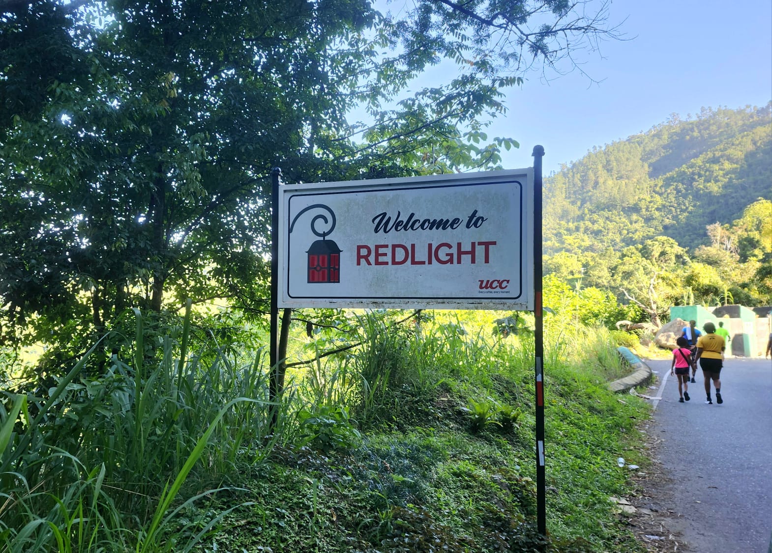
Wear proper footwear. The terrain varies between paved road, compacted dirt, and rocky hillside paths. Trail shoes or hiking boots are strongly recommended.
Carry enough water. There are limited refill points between Savage Pen and Irish Town. Carry at least two litres from the start.
Know the geology. The area sits on the Wagwater Group formation, characterized by clay soil, steep slopes, and low water percolation. Landslips are a regular occurrence after heavy rain. Check the weather before you go and avoid the trail in wet conditions.
This is a community road. Savage Pen Road is an active thoroughfare for residents, farmers, and vehicles. Stay aware of your surroundings, especially on the lower section.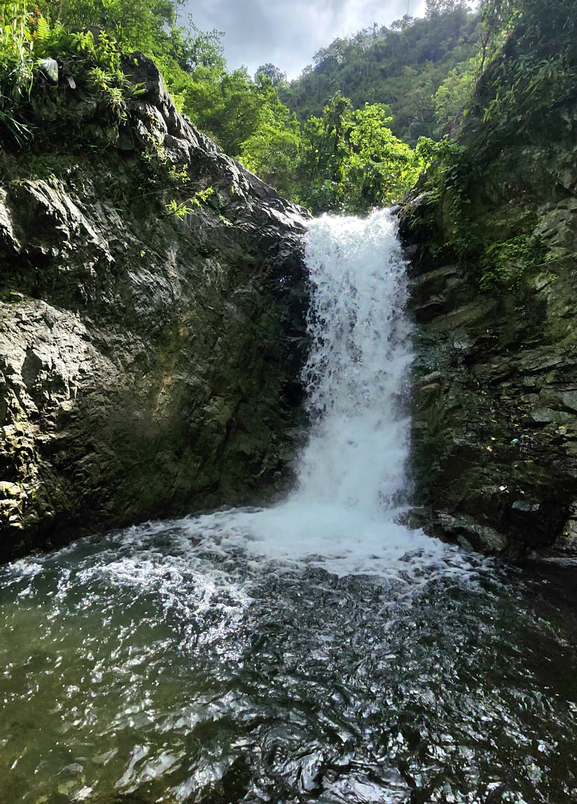
Frequently Asked Questions
How difficult is the Savage Pen hike in Jamaica?
The Savage Pen to Penfield route is rated Level 7 out of 10. The 1.6-kilometre opening climb is steep and relentless. The full seven-mile route requires solid fitness and endurance.
Where does the Savage Pen hike start?
The hike starts at Savage Pen Road in Gordon Town, St. Andrew, approximately 30 minutes from Papine by road.
How long does the Savage Pen to Penfield hike take?
Expect between four and six hours, depending on pace, rest stops, and group size.
Why is Savage Pen Road famous in Jamaica?
Savage Pen Road became nationally known after the 2020 Gordon Town Road collapse caused by Tropical Storm Eta. The NWA converted the road from a narrow footpath into a two-lane emergency bypass in weeks, making it a lifeline for thousands of St. Andrew hill residents.
Is Savage Pen Road safe to hike?
Yes, the road is paved and well-maintained. Exercise standard trail awareness, be mindful of vehicles, and avoid hiking after heavy rainfall due to landslip risk in the area.
Join Lifestyle Hikers
Lifestyle Hikers is a free Jamaica-based hiking community with over 50 members, 200 hikes completed, and 50-plus trails explored across the island. If this trail looks like your kind of Saturday, come find us.
Follow us on Instagram: @lifestylehikers Website: lifestylehikers.com
Savage Pen to Penfield is not just a hard hike. It is a walk through Jamaican history, geology, agriculture, and community survival.
Start with a prayer. End with a story worth telling.